Tropical Cyclone to hit northern Somalia in less than 24 hrs-forescast
The UK Meteorological Office has warned of an imminent tropical cyclone at the eastern Gulf of Aden in less than 24 hours’ time adding Northern Somalia and Southern Yemen will experience exceptionally high rainfall totals causing severe flash flooding across the region.
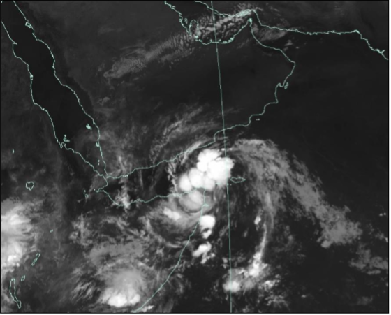
The forecast released Wednesday indicates a build-up of the cyclone has been witnessed in Socotra Island which has experienced thunderstorms and is expected to progress northwestwards into the Gulf of Aden.
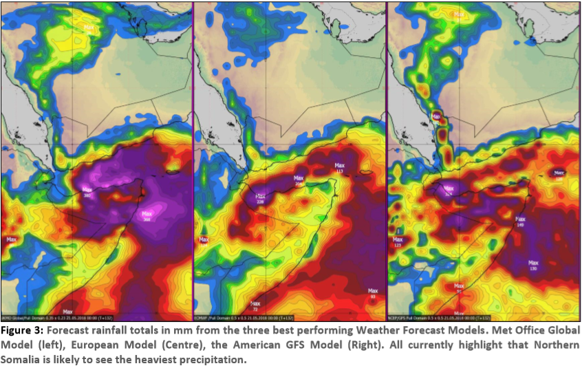
“In the scenario of a track along the centre of the Gulf of Aden, it looks likely that precipitation totalling between 50-100mm will fall over both the coastal strips of Yemen and Somalia, with a close pass or landfall from this system leading to a risk of rainfall totals exceeding 250mm,” the Met Office said.
Across Northern Somalia, 50-100mm of rain could fall widely, with peaks in excess of 250m, the forecast notes, warning river flooding across the region will lead to a loss of human life, livestock, and the destruction of crops, property and infrastructure.
The northern city of Bosaso in Somalia is estimated to be home to 165,000 people.
The office adds the forecast appears to be a severe as the 2013 Somali Cyclone, but slightly below the severity of the 2008 Yemen Cyclone. However, much will depend upon the track of the cyclone over the coming days.
“It must be stressed that heavy rainfall will cause the most impact from this cyclone, with impacts likely in Southern Yemen and across much of Northern Somalia.”
Modest amounts of precipitation would bring flash flooding to these areas, with people, animals and crops in these flooded zones likely to be washed away. With large amounts of rainfall likely over the coming days, there is the potential for very serious impacts on the region.